

Quick answer
The route runs roughly 70 km from the Mollepata trailhead in the Cusco Region to Aguas Calientes, topping out at the Salkantay Pass near 4,630 m before descending to about 2,000 m at Santa Teresa. Access is community-regulated, with a 30 PEN fee collected at Mollepata. Arriving between 06:00 and 09:00 keeps the first climb ahead of afternoon cloud forest rain.
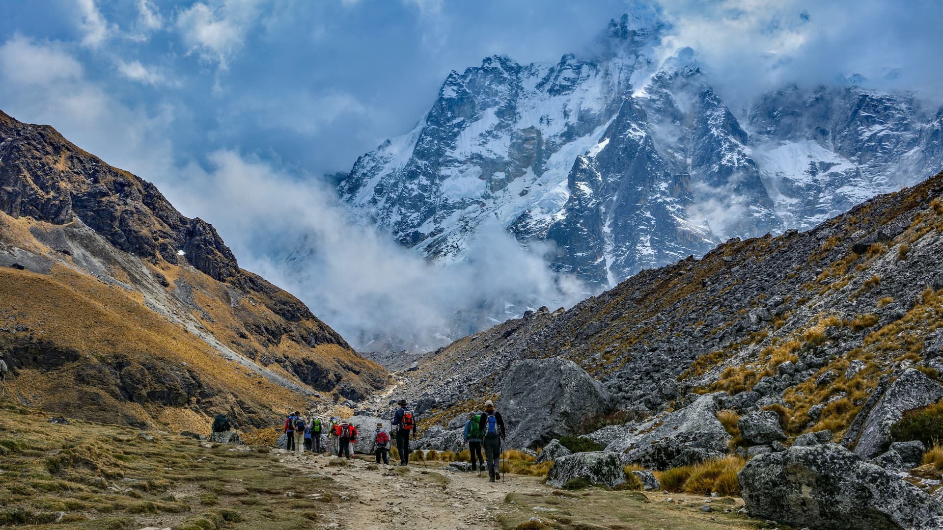
The Salkantay route was never designed as a trekking circuit. It is an old commercial corridor, used for generations to move goods between the highlands around Mollepata and the coffee and fruit terraces of the Santa Teresa valley. That commercial logic explains the profile a 5 day salkantay trek map reveals: the line does not wander scenically, it climbs hard to the lowest crossable saddle beneath Nevado Salkantay, then loses altitude as fast as the terrain allows. The geography breaks into three distinct bands, and most confusion about the ruta Salkantay comes from treating them as one landscape. The first band is puna grassland above Soraypampa, treeless and cold, with the Humantay lagoon sitting in a side valley off the main line. The second is the pass itself, a rubble saddle between Salkantay and Tucarhuay where snowmelt runs off in both directions. The third is subtropical: Chaullay, Lucmabamba, coffee smallholdings, and the humid switchbacks toward Llactapata, where the ruins face Machu Picchu across the Urubamba gorge. Contour lines flatten in this last band, which misleads people into assuming easy walking, when in fact the heat and humidity do the work the altitude did earlier. Orientation on the ground is generally straightforward. The corridor is well travelled, muleteers use it daily, and junctions near Collpapampa and Playa Sahuayaco are signed or obvious. Even so, most walkers carry a GPX file alongside a printed sheet, because cloud cover in the cordillera can erase every visual landmark within minutes and phone batteries fade at altitude. Fixed points worth marking before departure are the Mollepata trailhead, Soraypampa, the pass, Chaullay, Lucmabamba and the Hidroeléctrica rail terminus. The practical value of a Salkantay Trek route map is not navigation but expectation-setting. It shows where water sources thin out, where the trail leaves any road access, and where a walker who is struggling can still be extracted by vehicle. It also explains why guidance stresses early departures: the highest ground should be crossed before the weather turns, and the geography leaves little room to make up lost hours. Read the 5 day salkantay trek map alongside the dedicated stage, timing and access sections on this site, and the shape of the walk becomes predictable rather than improvised.
“The Salkantay corridor was a trade route long before it was a trekking route, and the line on the map still shows it.”
5 Day Salkantay Trek Map and Daily Itinerary
This five-day plan suits trekkers with reasonable fitness who want the full Mollepata-to-Aguas Calientes route, covering roughly 70 km and an elevation range from 2,900 m to the 4,630 m Salkantay Pass. Days are structured as five walking stages, with the fifth ending at Machu Picchu.
Mollepata to Soraypampa
Leave the Mollepata trailhead in the 06:00–09:00 arrival window and walk the Cachora canal path to Soraypampa at 3,900 m, around 6 hours. Most groups add the side climb to Humantay Lake in the afternoon.
Soraypampa to Chaullay
The longest day: a 4-hour ascent to Salkantay Pass at 4,630 m beneath the glacier, then a long descent to Chaullay at 2,900 m. Expect 9 to 10 hours of walking and a sharp temperature swing at the top.
Chaullay to La Playa
Cloud forest walking beside the Santa Teresa river through Collpapampa and Winaypocco to La Playa at 2,100 m, about 6 hours. The trail turns muddy and humid here, so trekking poles help on the descents.
La Playa to Aguas Calientes
Climb to the Llactapata ruins at 2,700 m for the distant view across to Machu Picchu, descend to Hidroeléctrica, then follow the railway line 11 km into Aguas Calientes. Around 8 hours total.
Machu Picchu citadel
Enter the citadel early and follow the circuit route past the Sun Temple, main plaza and Intihuatana stone, roughly 3 hours. Return to Aguas Calientes afterwards for onward travel to Cusco.
How to Reach Your 5 Day Salkantay Trek Map Trailhead
The Salkantay Trek begins at the Mollepata trailhead in the Cusco Region of Peru. Most travelers access this remote starting point via road transit from the city of Cusco.
Private transfer from Cusco via Route 3S to Mollepata
Public bus from Cusco Arcopata terminal to Mollepata
Optimal Timing for Your 5 Day Salkantay Trek Map
The dry season, spanning May through September, offers the most stable conditions for the Salkantay Trek. During these months, clear skies provide consistent visibility, though adhering to the 06:00–09:00 arrival window remains essential to mitigate afternoon cloud forest rain.
Dry Season (May–Sept)
Moderate to HighClear skies, 0°C to 20°C
Expect cold nights and dry, sunny days perfect for mountain trekking.
Shoulder Season (April/Oct)
Low to ModerateMixed conditions, 5°C to 22°C
Increased chance of rain but fewer hikers on the trail.
Daily Arrival Window
Consistent—
Arrivals between 06:00–09:00 avoid afternoon rain and reduce exposure to peak sun.
Verdict: The best period for the trek is May or September, strictly maintaining a 06:00–09:00 arrival at the trailhead to navigate weather patterns effectively.
Essential Preparation for Your 5 Day Salkantay Trek Map
Preparation for the Salkantay route centres on altitude adaptation, tested gear, and paperwork sorted well before you reach Mollepata.
-
Reserve permits and huts months ahead — Salkantay bed space and any Inca Trail-linked segments sell out in high season.
-
Spend three days acclimatising in Cusco — Salkantay Pass sits near 4,600 m, and arriving straight from sea level invites altitude sickness.
-
Train with loaded hikes beforehand — Consecutive days of 6-8 hours on uneven ground demand conditioned legs and a broken-in pack.
-
Break in your boots early — Waterproof, ankle-supporting footwear must be blister-free before the cloud forest descent.
-
Pack layers for two climates — Sub-zero nights near the pass and humid heat below Santa Teresa call for the same rucksack.
-
Carry your original passport — Identity checks apply at control points and at Machu Picchu, and photocopies are not accepted.
-
Bring 30 PEN in small notes — The community-regulated access fee is collected in cash at the Mollepata trailhead.
-
Arrive at the trailhead 06:00-09:00 — Early starts avoid afternoon cloud forest rain and ensure progress before peak sun exposure.
Operating Hours for the 5 Day Salkantay Trek Map Route
The Salkantay Trek trailhead at Mollepata provides continuous access to the trail throughout the week. Hikers may begin their journey at any time.
| Monday | 00:00–23:59 | |
|---|---|---|
| Tuesday | 00:00–23:59 | |
| Wednesday | 00:00–23:59 | |
| Thursday | 00:00–23:59 | |
| Friday | 00:00–23:59 | |
| Saturday | 00:00–23:59 | |
| Sunday | 00:00–23:59 |
Check availability
Frequently asked questions about 5 day salkantay trek map
Everything you need to know about 5 day salkantay trek map